- Головна
- Готові шкільні презентації
- Презентація на тему «California» (варіант 3)
Презентація на тему «California» (варіант 3)
364
Слайд #1
Слайд #2
California is a state located on the West Coast of the United States. It is the most populous U.S. state, home to 1 out of 8 Americans, and is the third largest state by area (after Alaska and Texas). It is home to the nation's second and fifth most populous census statistical areas (Greater Los Angeles area and San Francisco Bay Area, respectively), and eight of the nation's 50 most populated cities (Los Angeles, San Diego, San Jose, San Francisco, Fresno, Sacramento, Long Beach, and Oakland). The capital city is Sacramento.
Слайд #3
California is a state located on the West Coast of the United States. It is the most populous U.S. state, home to 1 out of 8 Americans, and is the third largest state by area (after Alaska and Texas). It is home to the nation's second and fifth most populous census statistical areas (Greater Los Angeles area and San Francisco Bay Area, respectively), and eight of the nation's 50 most populated cities (Los Angeles, San Diego, San Jose, San Francisco, Fresno, Sacramento, Long Beach, and Oakland). The capital city is Sacramento.
Слайд #4
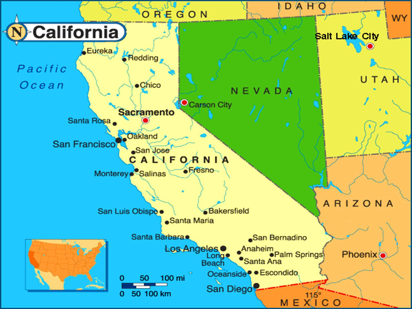
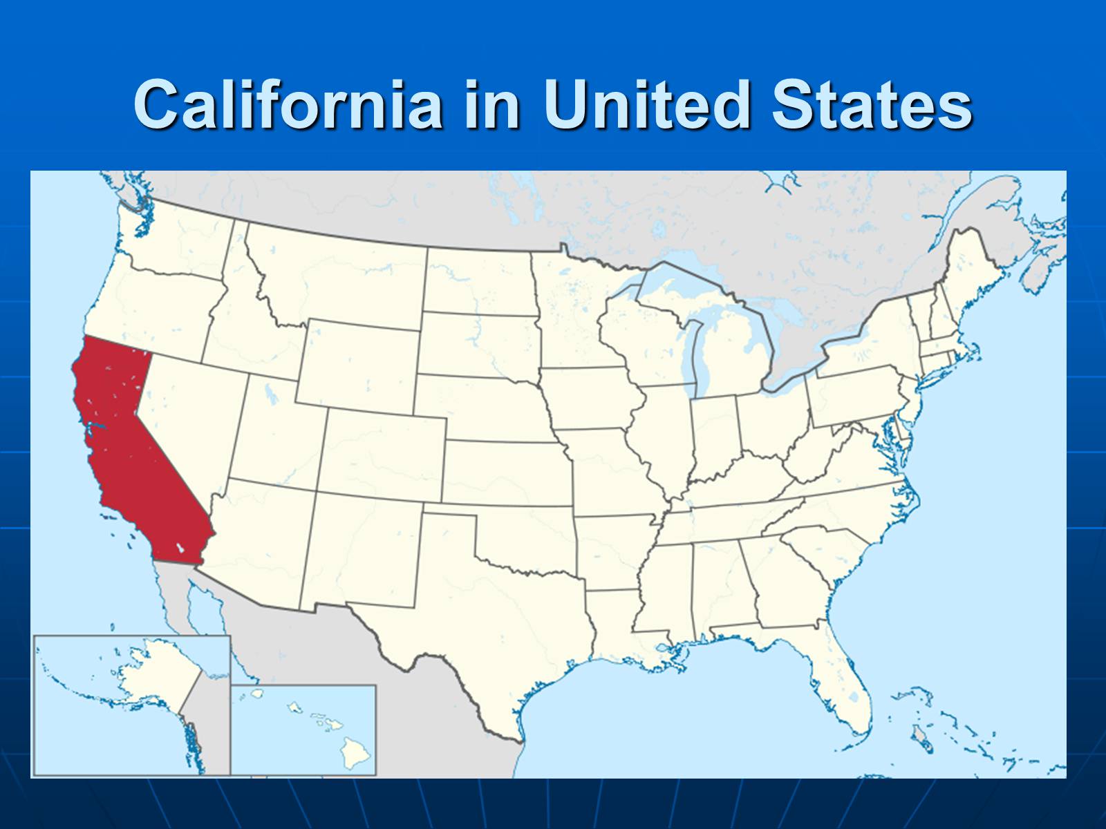
California is bordered by Oregon to the north, Nevada to the east, Arizona to the southeast, and the Mexican State of Baja California to the south. California's diverse geography ranges from the Pacific Coast in the west, to the Sierra Nevada in the east – from the Redwood–Douglas-fir forests of the northwest, to the Mojave Desert areas in the southeast. The center of the state is dominated by the Central Valley, a major agricultural area. California contains both the highest and lowest points in the contiguous United States (Mount Whitney and Death Valley), and has the 3rd longest coastline of all states (after Alaska and Florida).
Слайд #5
California in United States
Слайд #6
The word California originally referred to the entire region composed of the Baja California peninsula of Mexico, the current U.S. states of California, Nevada, and Utah, and parts of Arizona, New Mexico, and Wyoming.
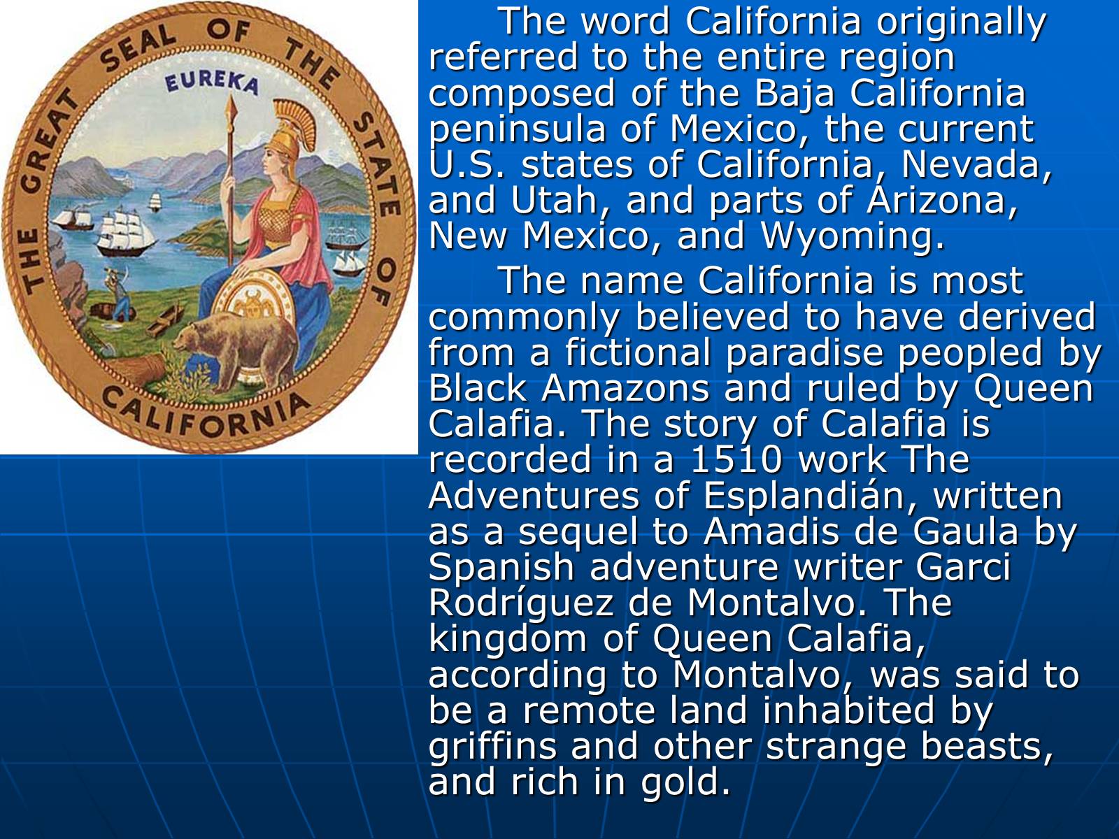
The name California is most commonly believed to have derived from a fictional paradise peopled by Black Amazons and ruled by Queen Calafia. The story of Calafia is recorded in a 1510 work The Adventures of Esplandián, written as a sequel to Amadis de Gaula by Spanish adventure writer Garci Rodríguez de Montalvo. The kingdom of Queen Calafia, according to Montalvo, was said to be a remote land inhabited by griffins and other strange beasts, and rich in gold.
The name California is most commonly believed to have derived from a fictional paradise peopled by Black Amazons and ruled by Queen Calafia. The story of Calafia is recorded in a 1510 work The Adventures of Esplandián, written as a sequel to Amadis de Gaula by Spanish adventure writer Garci Rodríguez de Montalvo. The kingdom of Queen Calafia, according to Montalvo, was said to be a remote land inhabited by griffins and other strange beasts, and rich in gold.
Слайд #7
California is the 3rd largest state in the United States in size, after Alaska and Texas.
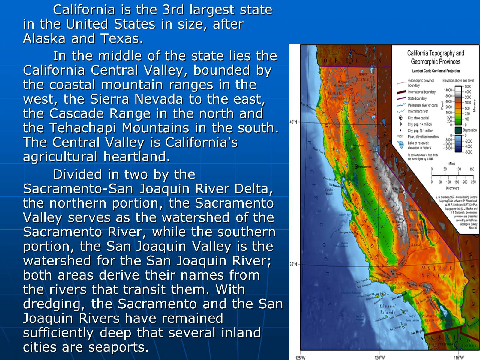
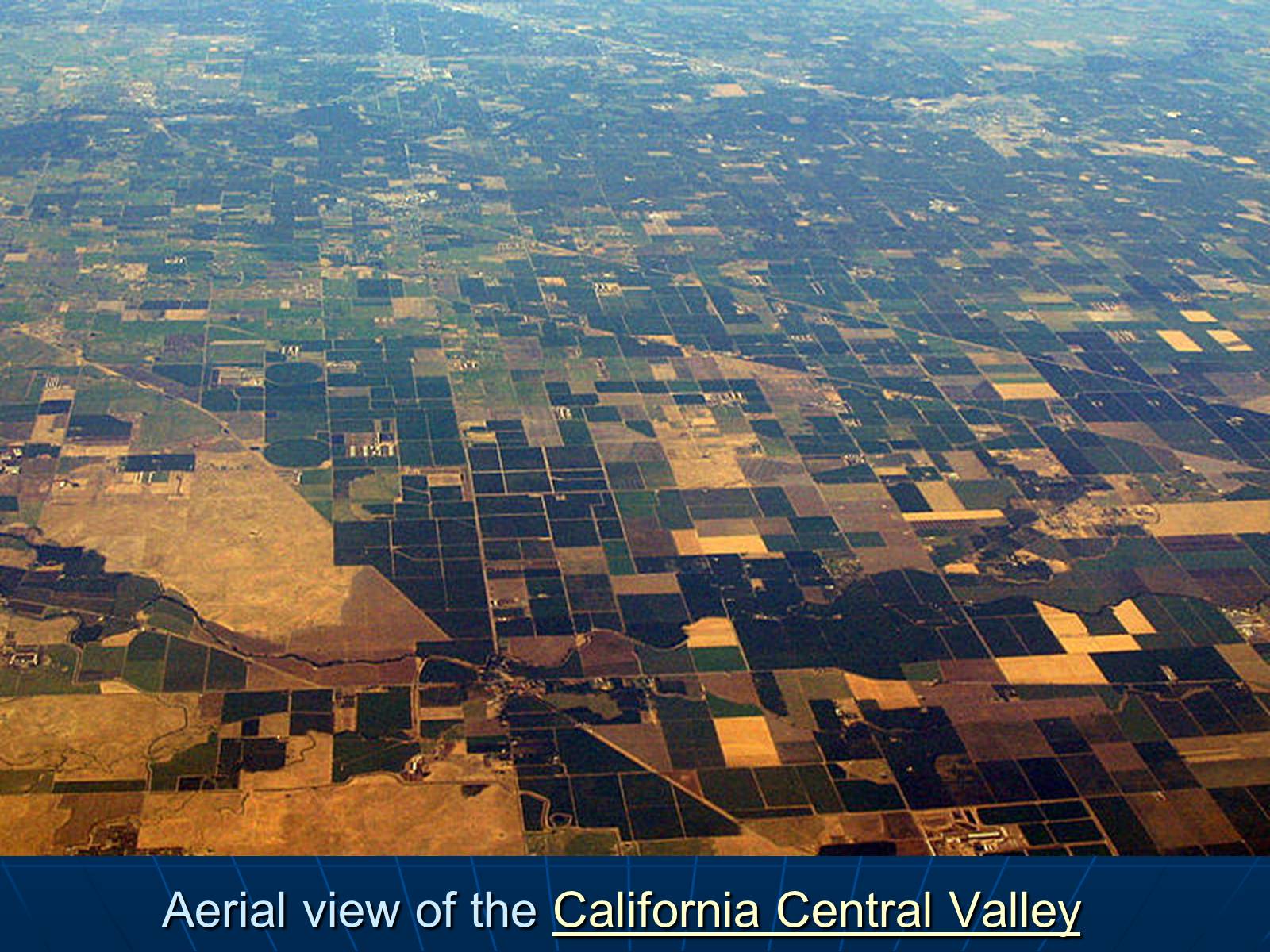
In the middle of the state lies the California Central Valley, bounded by the coastal mountain ranges in the west, the Sierra Nevada to the east, the Cascade Range in the north and the Tehachapi Mountains in the south. The Central Valley is California's agricultural heartland.
Divided in two by the Sacramento-San Joaquin River Delta, the northern portion, the Sacramento Valley serves as the watershed of the Sacramento River, while the southern portion, the San Joaquin Valley is the watershed for the San Joaquin River; both areas derive their names from the rivers that transit them. With dredging, the Sacramento and the San Joaquin Rivers have remained sufficiently deep that several inland cities are seaports.
Слайд #8
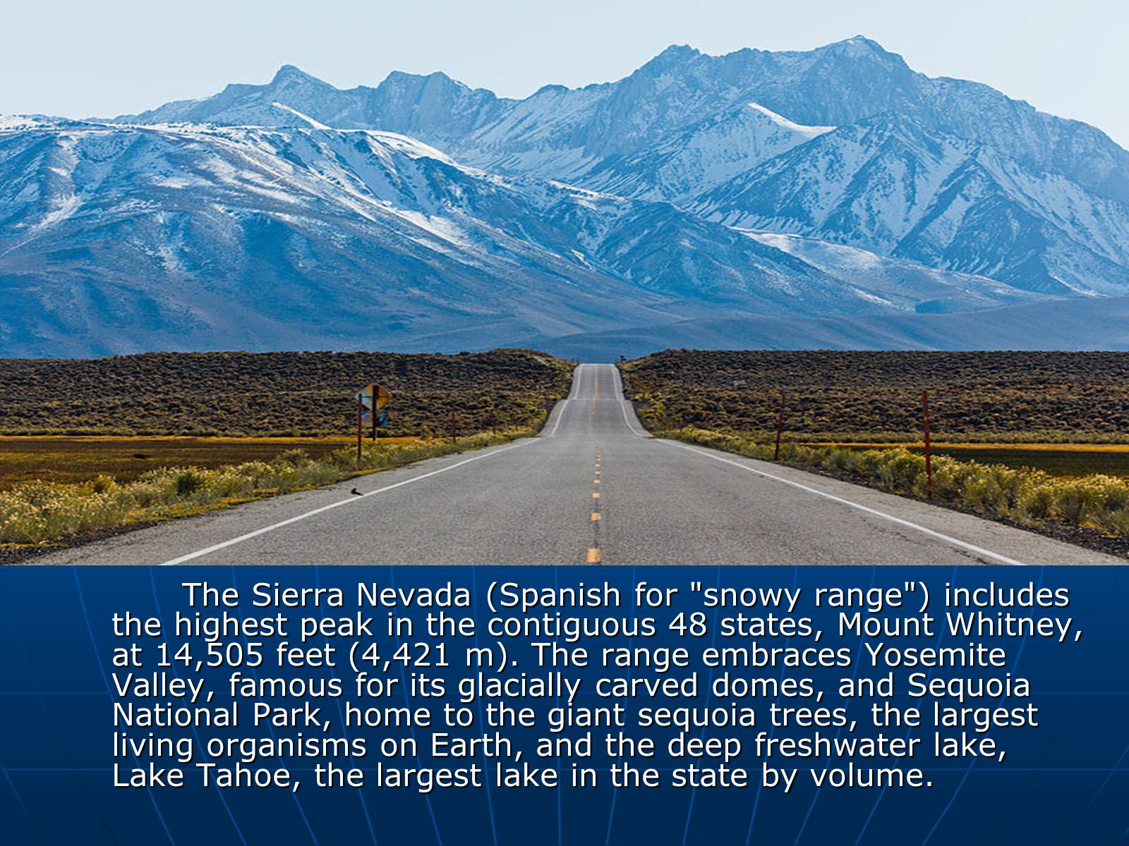
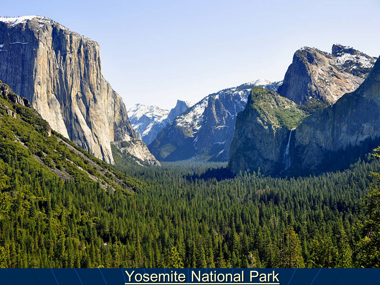
The Sierra Nevada (Spanish for "snowy range") includes the highest peak in the contiguous 48 states, Mount Whitney, at 14,505 feet (4,421 m). The range embraces Yosemite Valley, famous for its glacially carved domes, and Sequoia National Park, home to the giant sequoia trees, the largest living organisms on Earth, and the deep freshwater lake, Lake Tahoe, the largest lake in the state by volume.
Слайд #9
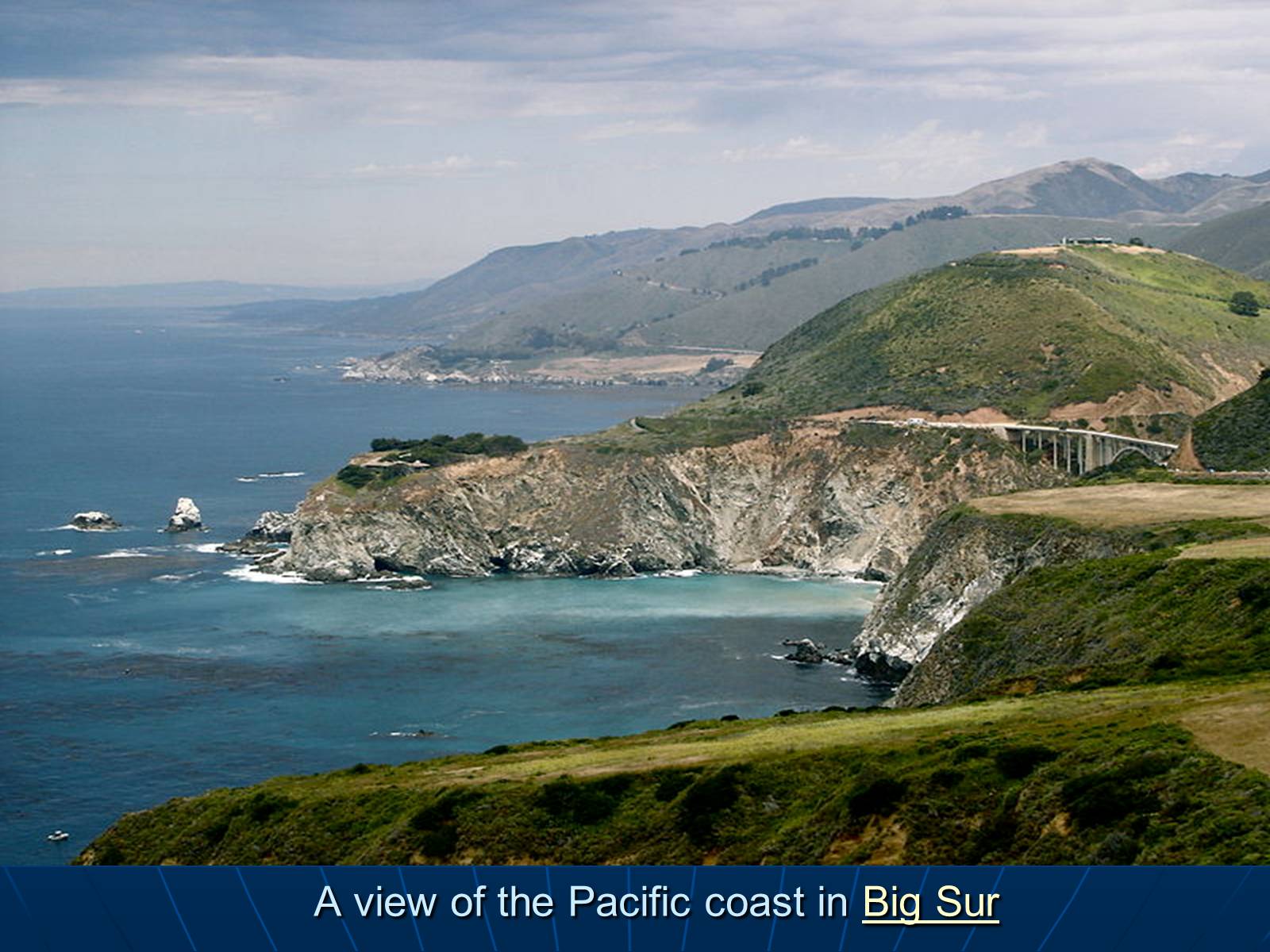
A view of the Pacific coast in Big Sur
Слайд #10
Aerial view of the California Central Valley
Слайд #11
Yosemite National Park
Слайд #12
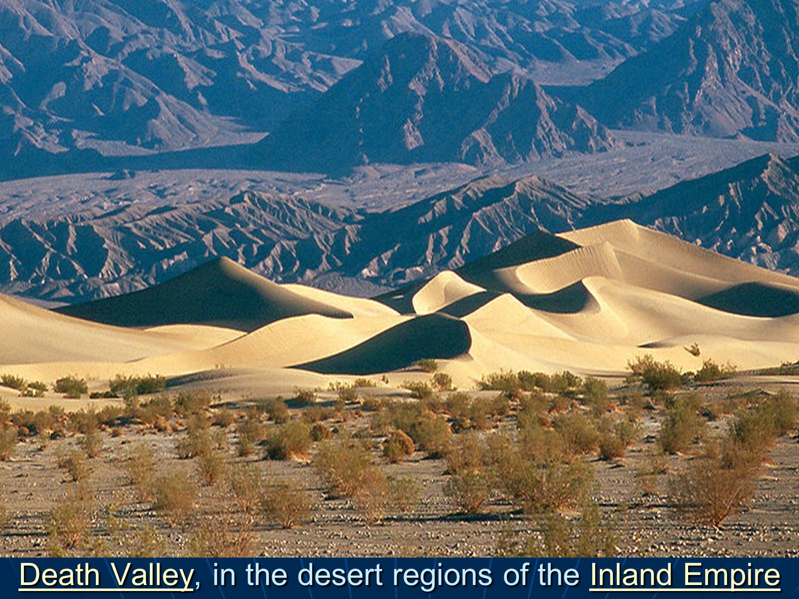
Death Valley, in the desert regions of the Inland Empire
Слайд #13
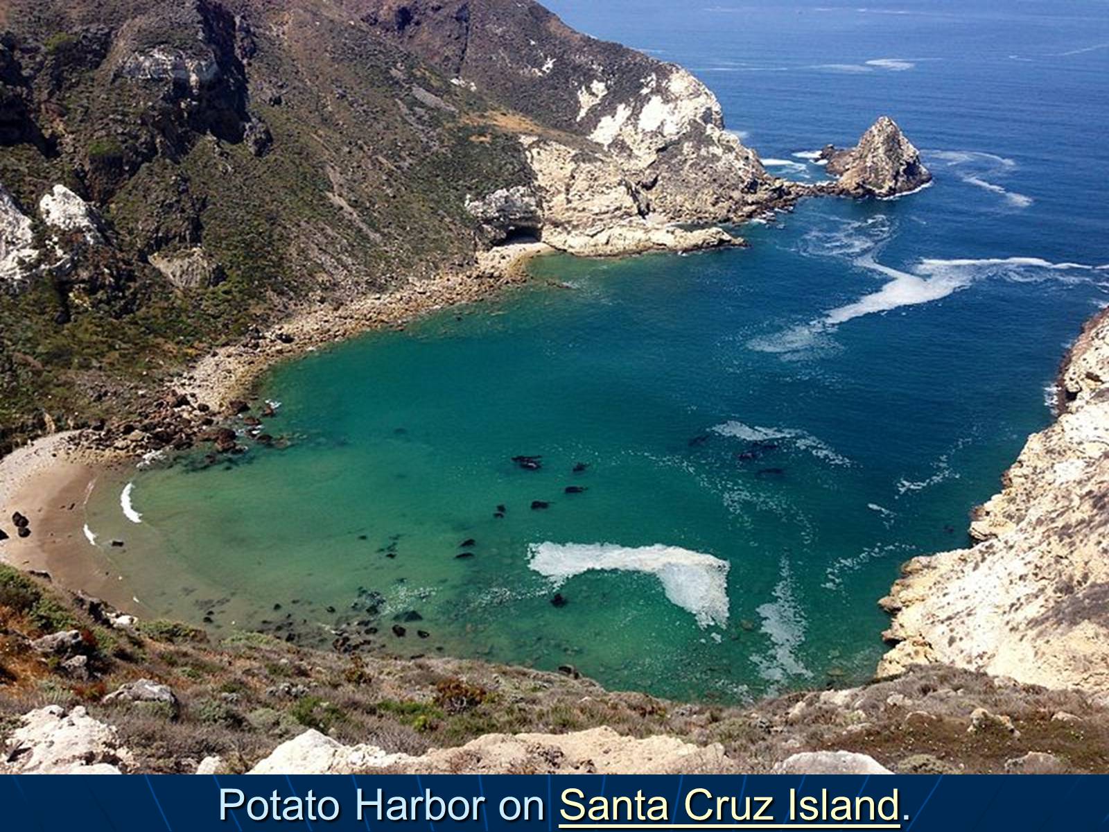
Potato Harbor on Santa Cruz Island.
Слайд #14
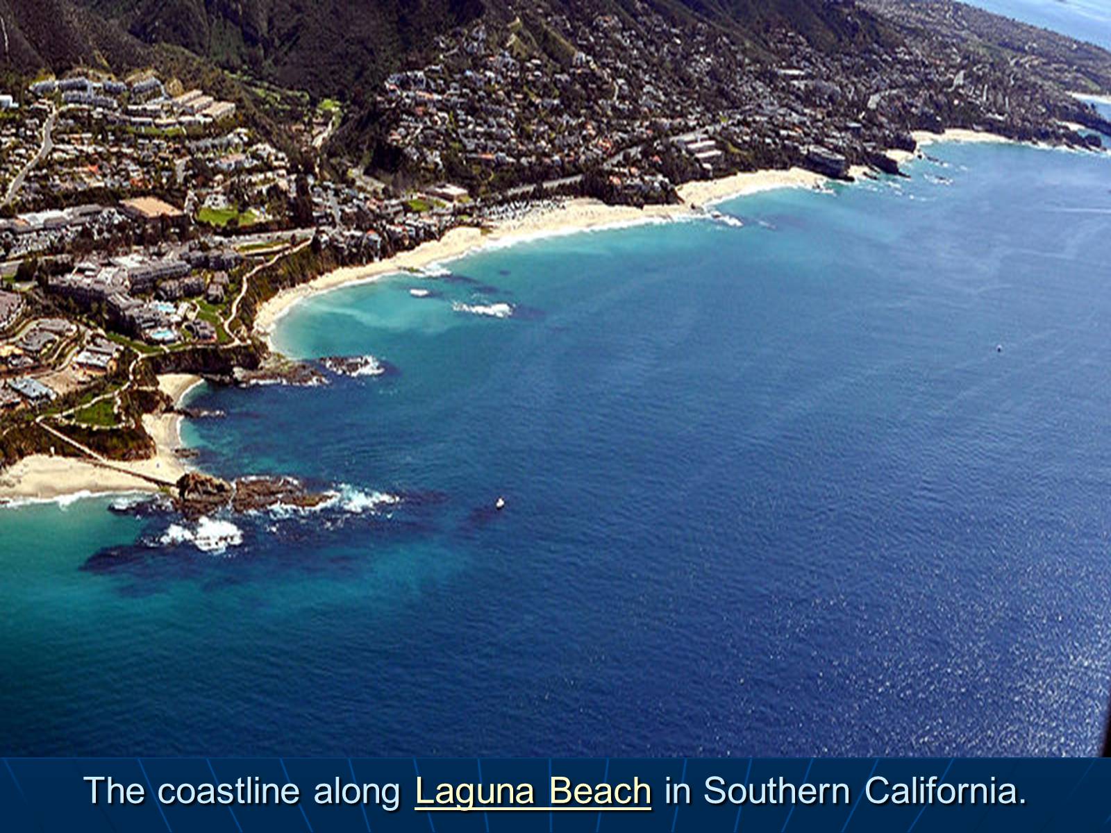
The coastline along Laguna Beach in Southern California.
Слайд #15
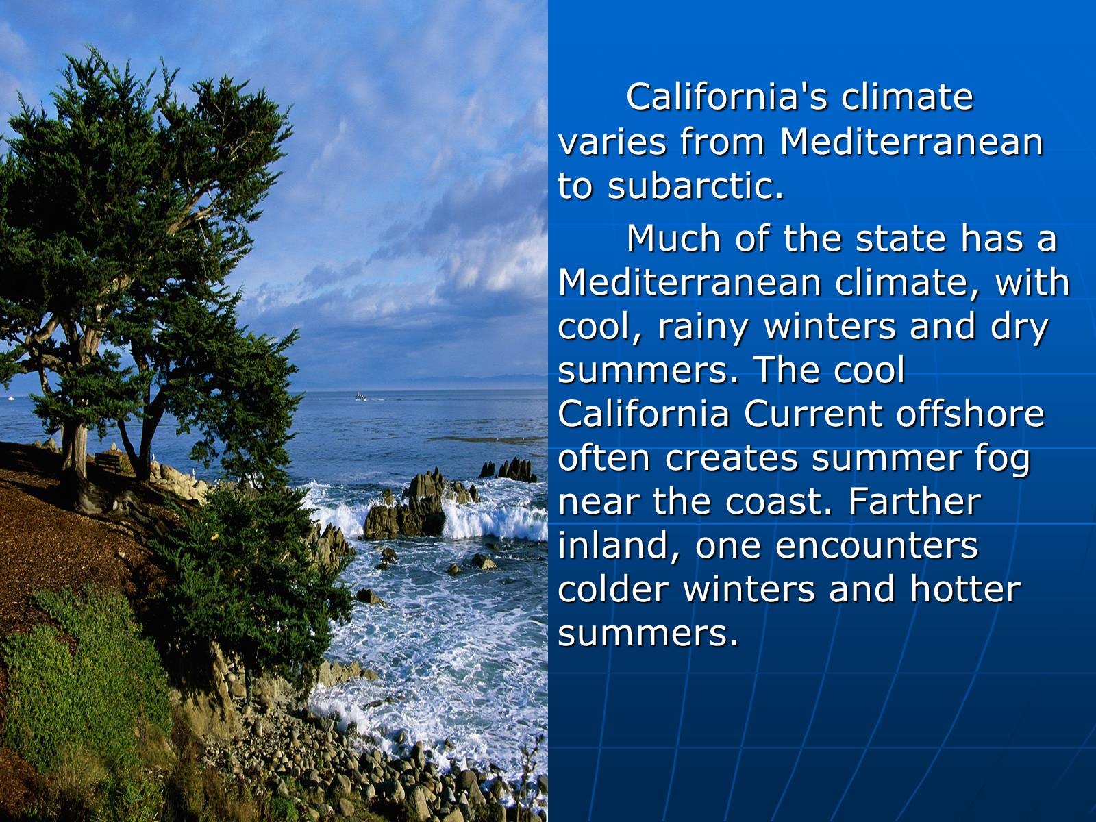
California's climate varies from Mediterranean to subarctic.
Much of the state has a Mediterranean climate, with cool, rainy winters and dry summers. The cool California Current offshore often creates summer fog near the coast. Farther inland, one encounters colder winters and hotter summers.
Much of the state has a Mediterranean climate, with cool, rainy winters and dry summers. The cool California Current offshore often creates summer fog near the coast. Farther inland, one encounters colder winters and hotter summers.
Слайд #16
California is one of the richest and most diverse parts of the world, and includes some of the most endangered ecological communities. California is part of the Nearctic ecozone and spans a number of terrestrial ecoregions.
California boasts several superlatives in its collection of flora: the largest trees, the tallest trees, and the oldest trees. California's native grasses are perennial plants. After European contact, these were generally replaced by invasive species of European annual grasses; and, in modern times, California's hills turn a characteristic golden-brown in summer.
California boasts several superlatives in its collection of flora: the largest trees, the tallest trees, and the oldest trees. California's native grasses are perennial plants. After European contact, these were generally replaced by invasive species of European annual grasses; and, in modern times, California's hills turn a characteristic golden-brown in summer.
Слайд #17
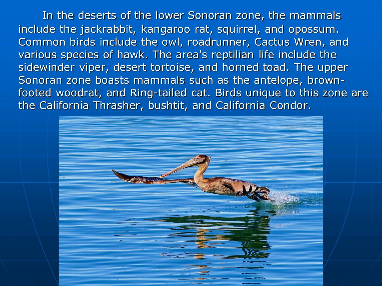
In the deserts of the lower Sonoran zone, the mammals include the jackrabbit, kangaroo rat, squirrel, and opossum. Common birds include the owl, roadrunner, Cactus Wren, and various species of hawk. The area's reptilian life include the sidewinder viper, desert tortoise, and horned toad. The upper Sonoran zone boasts mammals such as the antelope, brown-footed woodrat, and Ring-tailed cat. Birds unique to this zone are the California Thrasher, bushtit, and California Condor.
Слайд #18
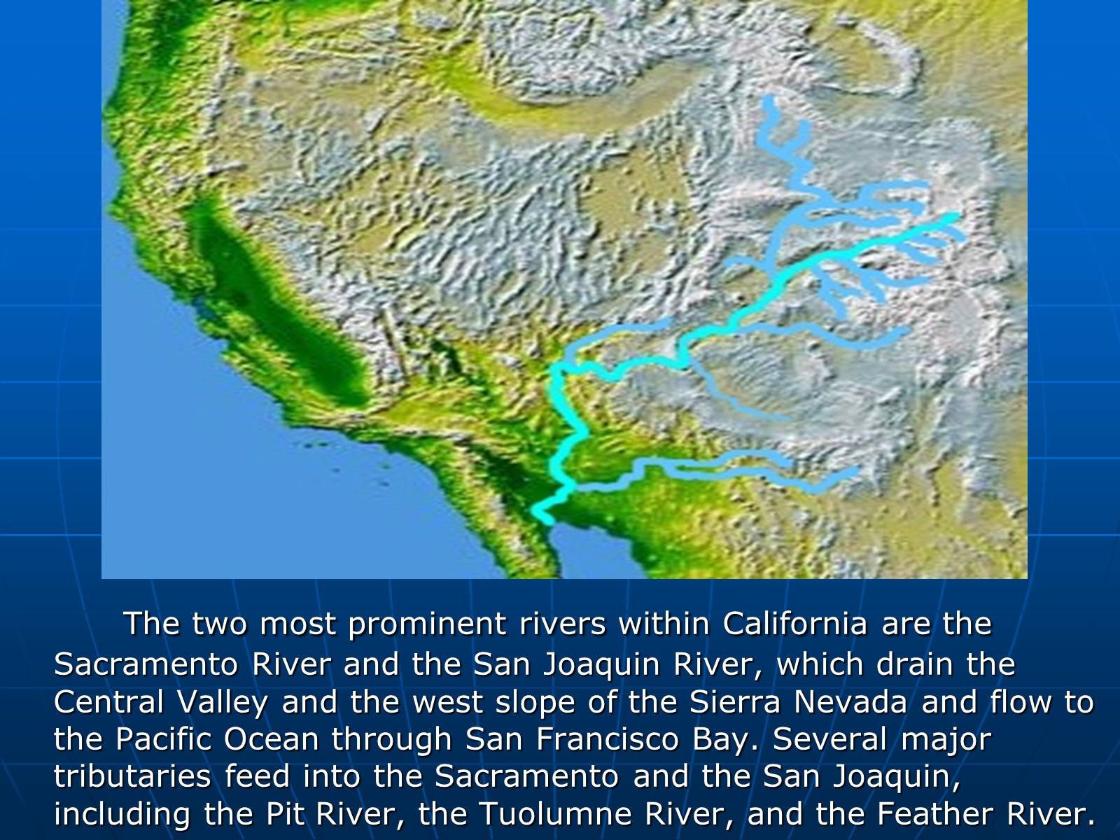
The two most prominent rivers within California are the Sacramento River and the San Joaquin River, which drain the Central Valley and the west slope of the Sierra Nevada and flow to the Pacific Ocean through San Francisco Bay. Several major tributaries feed into the Sacramento and the San Joaquin, including the Pit River, the Tuolumne River, and the Feather River.
Слайд #19
The first European effort to explore the coast as far north as the Russian River was a Spanish sailing expedition, led by Portuguese captain Juan Rodríguez Cabrillo, in 1542. Some 37 years later English explorer Francis Drake also explored and claimed an undefined portion of the California coast in 1579. Spanish traders made unintended visits with the Manila Galleons on their return trips from the Philippines beginning in 1565.[39] Sebastián Vizcaíno explored and mapped the coast of California in 1602 for New Spain.
Finally, after the Portola expedition of 1769-70, Spanish missionaries began setting up 21 California Missions on or near the coast of Alta (Upper)California, beginning in San Diego. During the same period, Spanish military forces built several forts (presidios) and three small towns (pueblos). Two of the pueblos grew into the cities of Los Angeles and San Jose.
Finally, after the Portola expedition of 1769-70, Spanish missionaries began setting up 21 California Missions on or near the coast of Alta (Upper)California, beginning in San Diego. During the same period, Spanish military forces built several forts (presidios) and three small towns (pueblos). Two of the pueblos grew into the cities of Los Angeles and San Jose.
Слайд #20
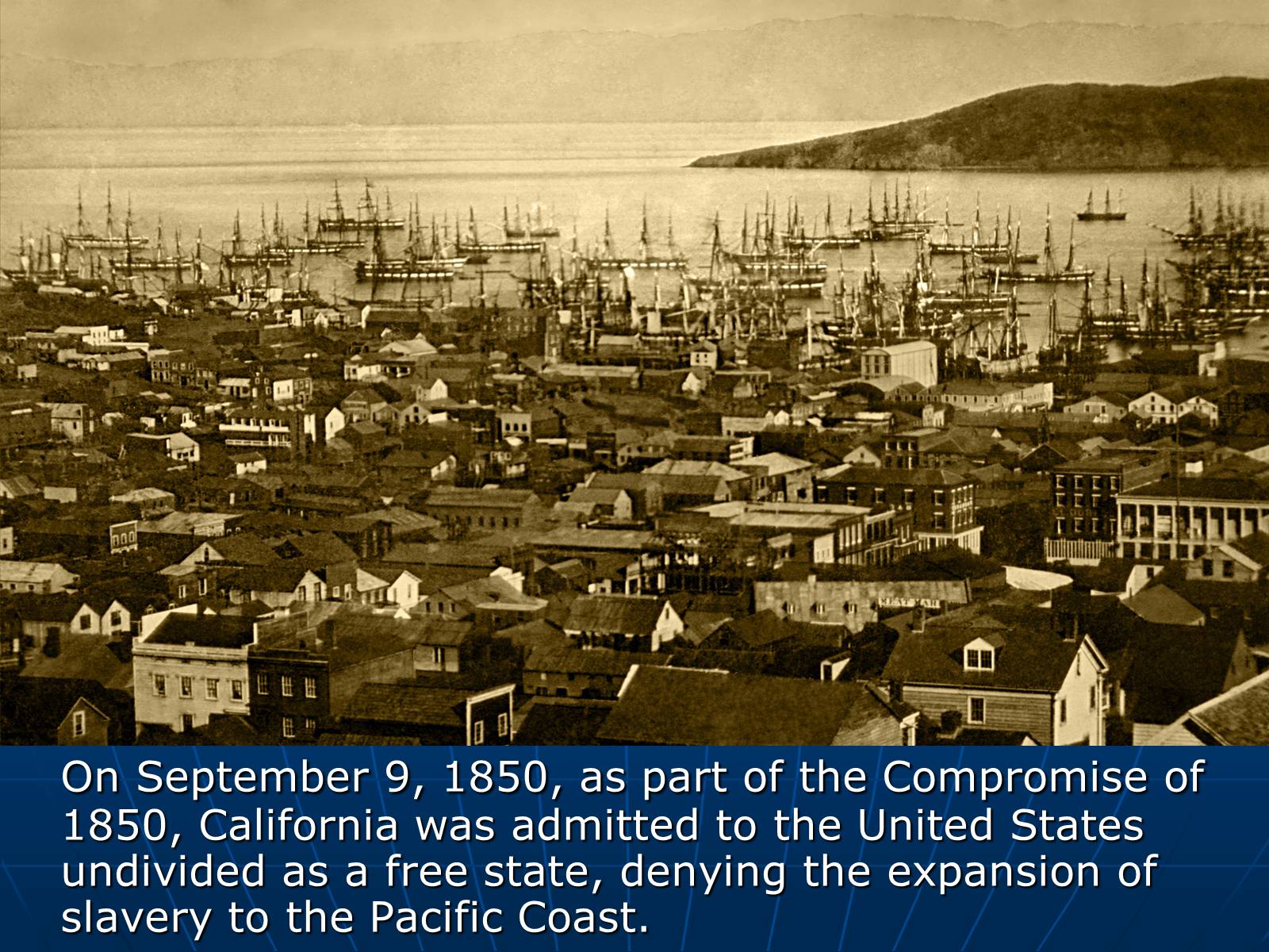
On September 9, 1850, as part of the Compromise of 1850, California was admitted to the United States undivided as a free state, denying the expansion of slavery to the Pacific Coast.
Слайд #21
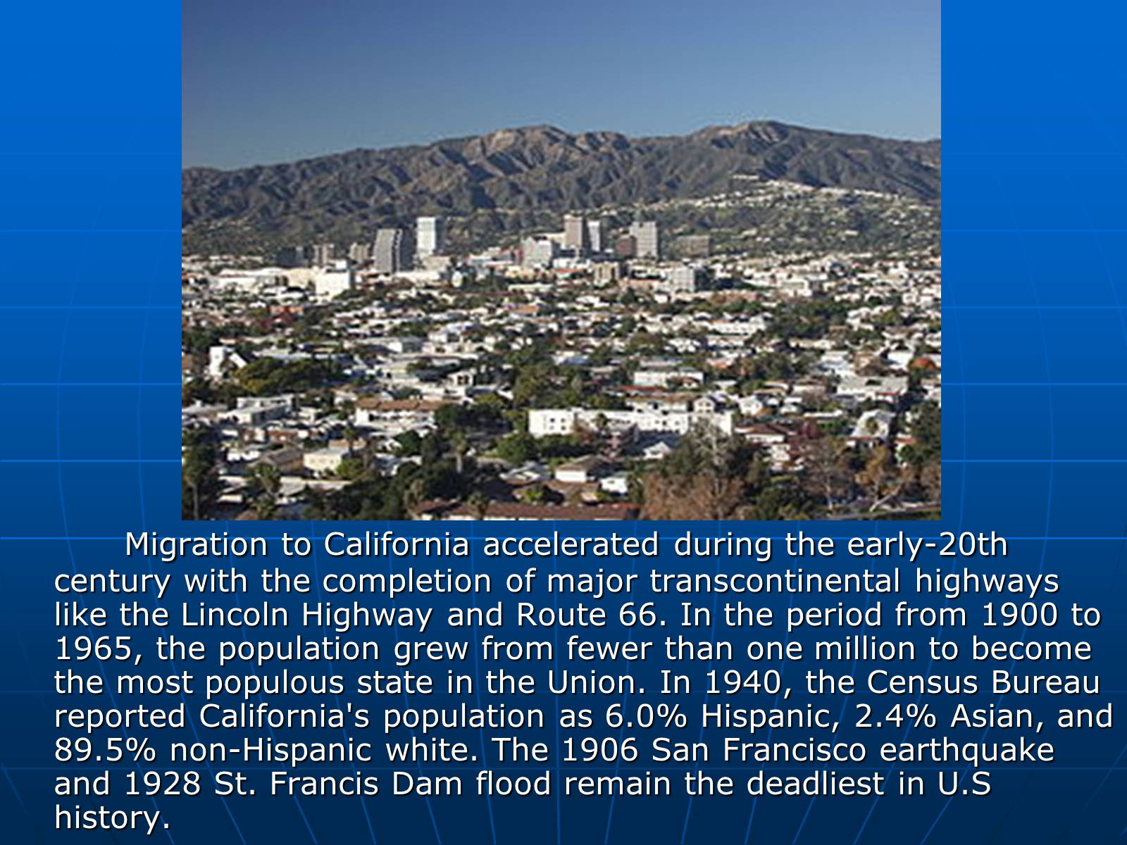
Migration to California accelerated during the early-20th century with the completion of major transcontinental highways like the Lincoln Highway and Route 66. In the period from 1900 to 1965, the population grew from fewer than one million to become the most populous state in the Union. In 1940, the Census Bureau reported California's population as 6.0% Hispanic, 2.4% Asian, and 89.5% non-Hispanic white. The 1906 San Francisco earthquake and 1928 St. Francis Dam flood remain the deadliest in U.S history.
Слайд #22
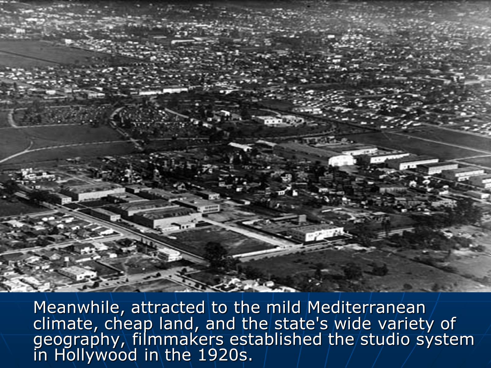
Meanwhile, attracted to the mild Mediterranean climate, cheap land, and the state's wide variety of geography, filmmakers established the studio system in Hollywood in the 1920s.
Слайд #23
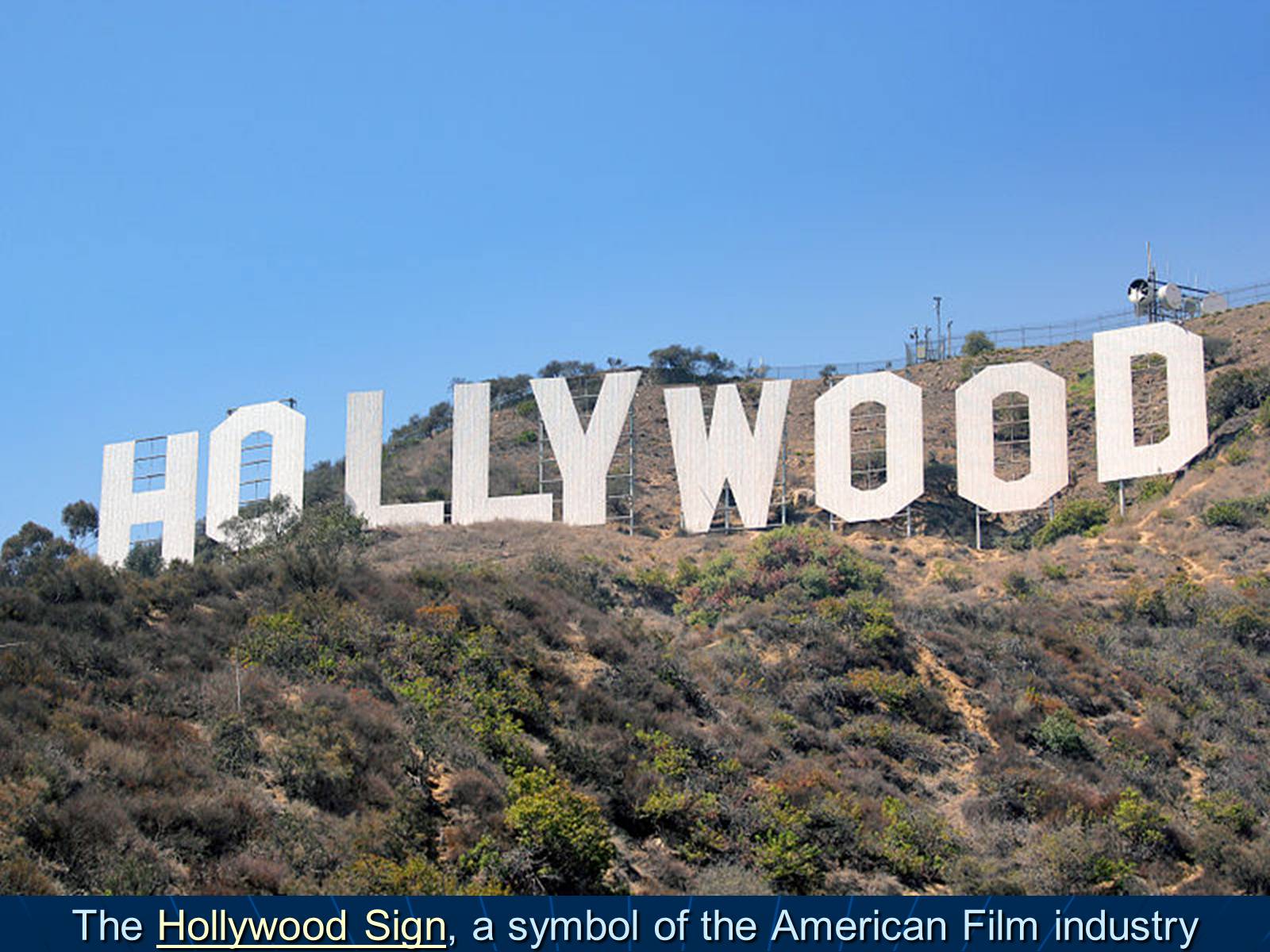
The Hollywood Sign, a symbol of the American Film industry
Слайд #24
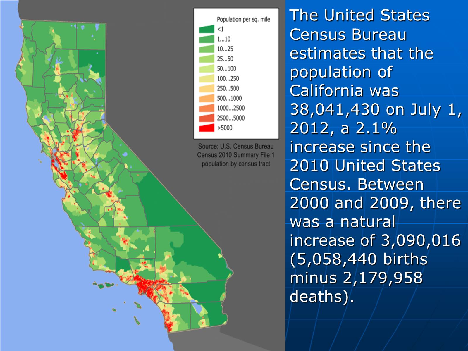
The United States Census Bureau estimates that the population of California was 38,041,430 on July 1, 2012, a 2.1% increase since the 2010 United States Census. Between 2000 and 2009, there was a natural increase of 3,090,016 (5,058,440 births minus 2,179,958 deaths).
Слайд #25
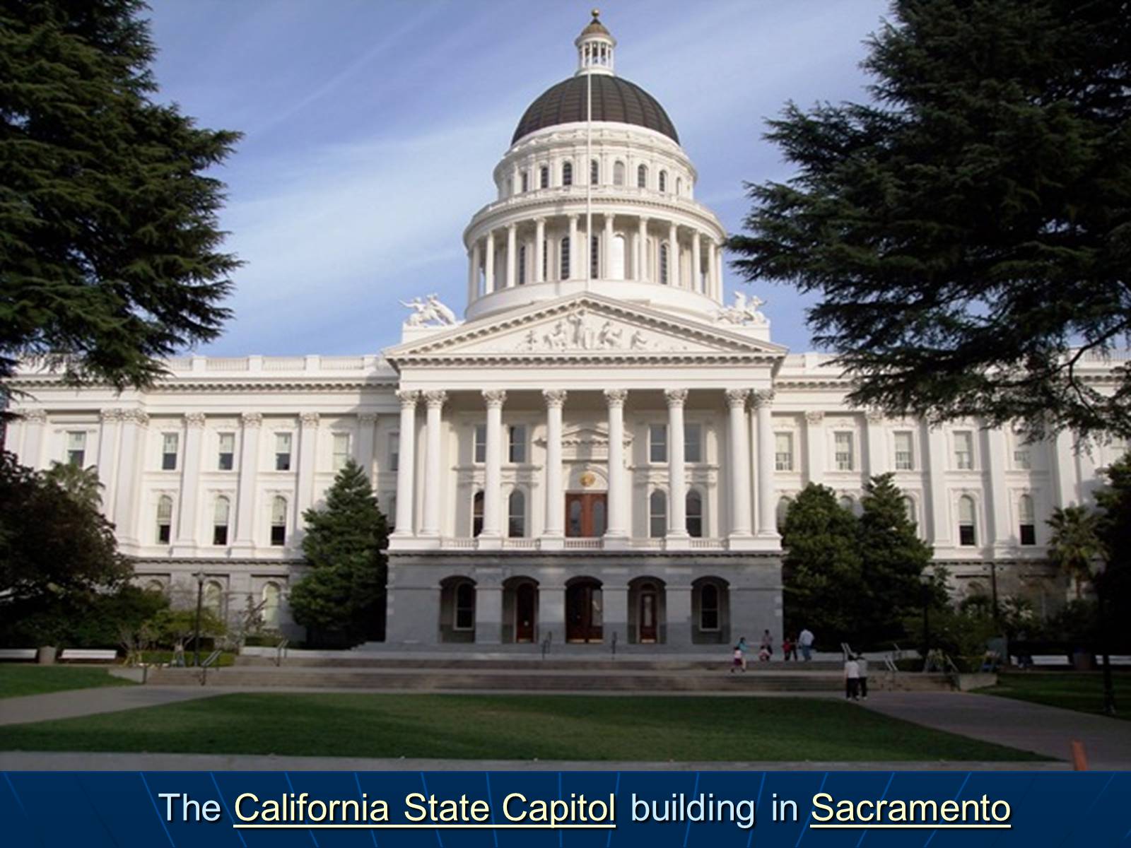
The California State Capitol building in Sacramento
Слайд #26
California is governed as a republic, with three branches of government – the executive branch consisting of the Governor and the other independently elected constitutional officers; the legislative branch consisting of the Assembly and Senate; and the judicial branch consisting of the Supreme Court of California and lower courts of California. The state also allows direct participation of the electorate by initiative, referendum, recall, and ratification. California allows each political party to choose whether to have a closed primary or a primary where only party members and independents vote. The state's capital is Sacramento.
Слайд #27
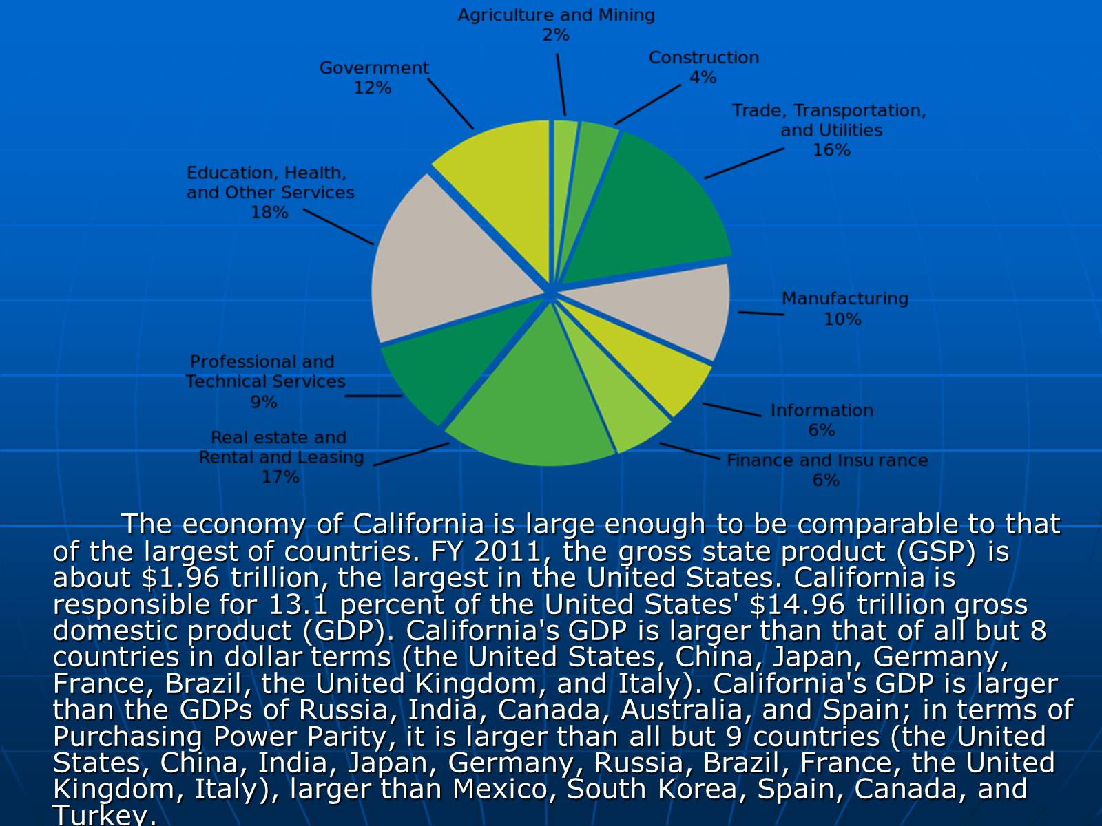
The economy of California is large enough to be comparable to that of the largest of countries. FY 2011, the gross state product (GSP) is about $1.96 trillion, the largest in the United States. California is responsible for 13.1 percent of the United States' $14.96 trillion gross domestic product (GDP). California's GDP is larger than that of all but 8 countries in dollar terms (the United States, China, Japan, Germany, France, Brazil, the United Kingdom, and Italy). California's GDP is larger than the GDPs of Russia, India, Canada, Australia, and Spain; in terms of Purchasing Power Parity, it is larger than all but 9 countries (the United States, China, India, Japan, Germany, Russia, Brazil, France, the United Kingdom, Italy), larger than Mexico, South Korea, Spain, Canada, and Turkey.
Слайд #28
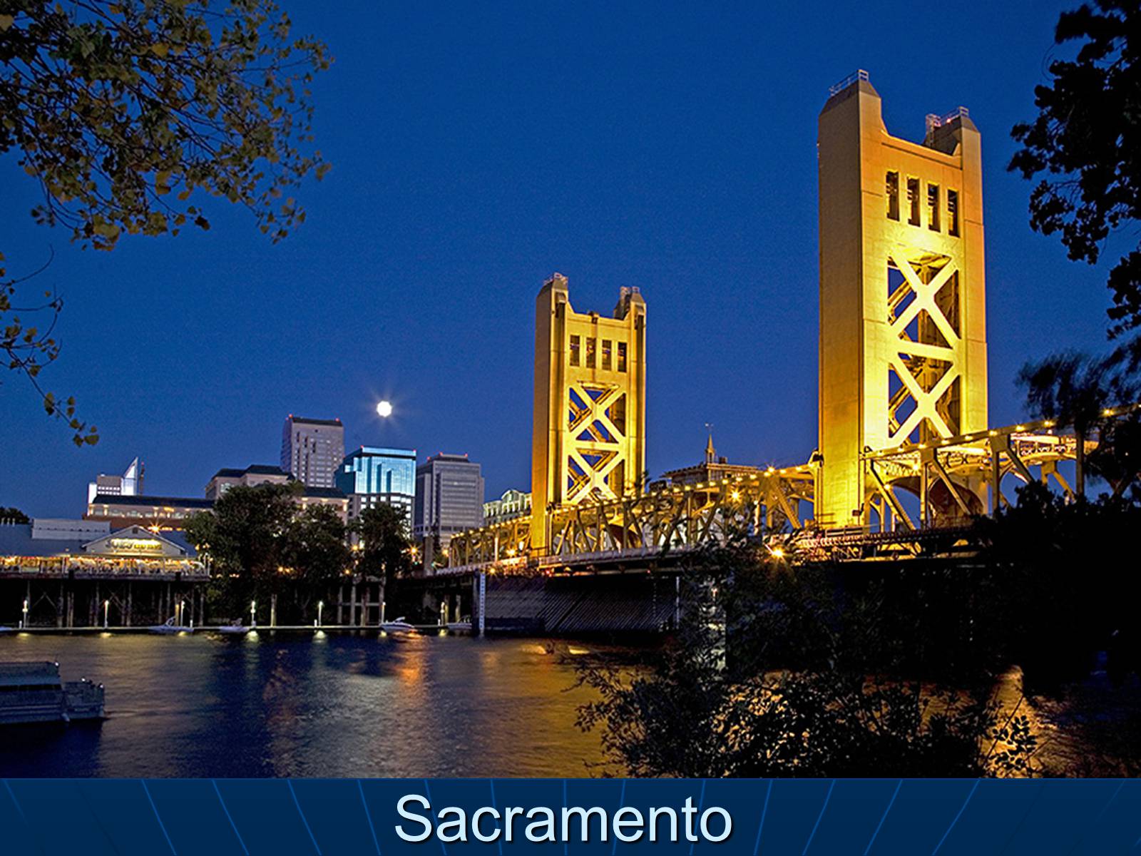
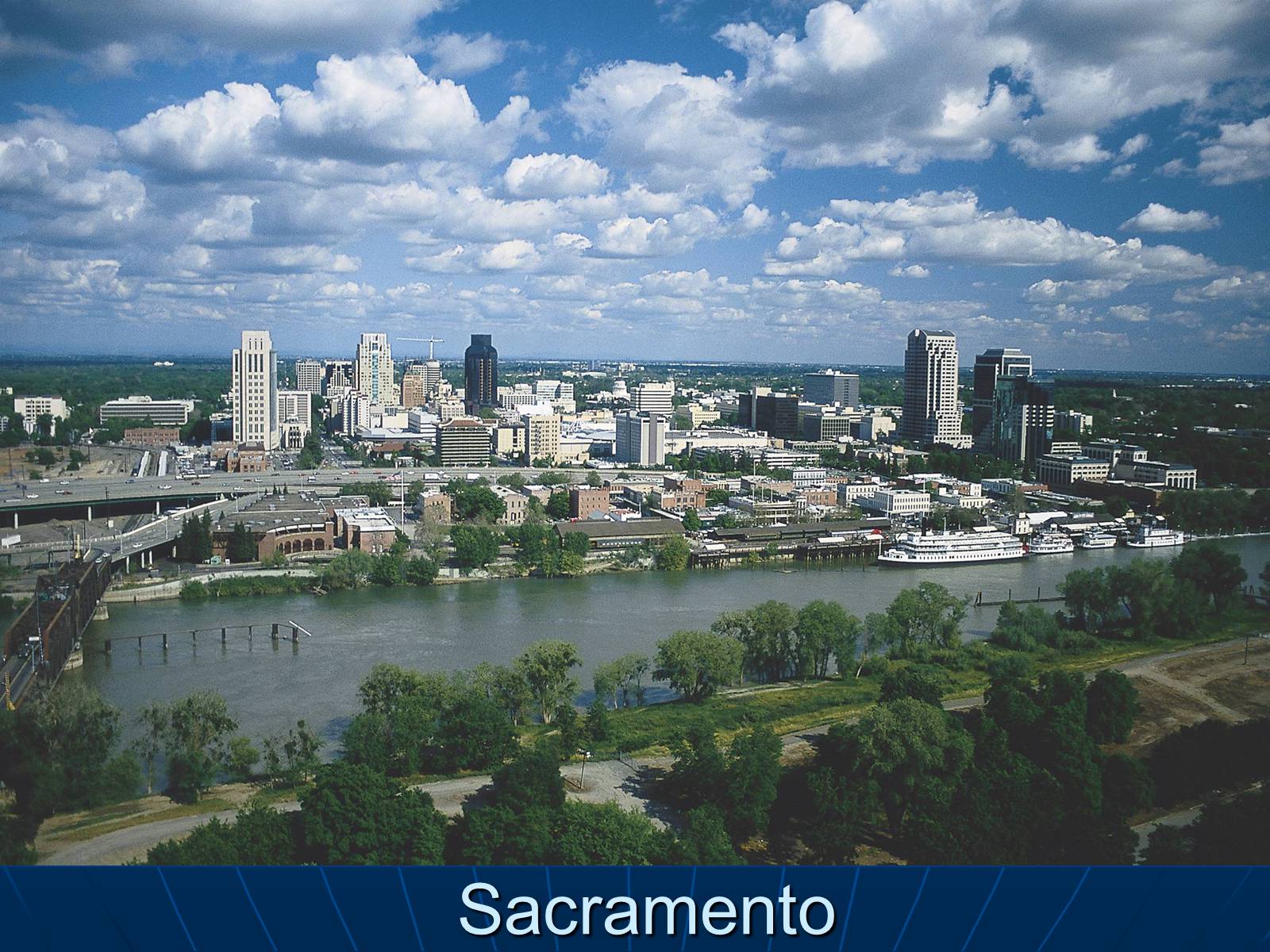
Sacramento
Слайд #29
The state's local government is divided into 58 counties and 482 incorporated cities and towns; of which 460 are cities and 22 are towns. Under California law, the terms "city" and "town" are explicitly interchangeable; the name of an incorporated municipality in the state can either be "City of (Name)" or "Town of (Name)".
Sacramento became California's first incorporated city on February 27, 1850. San Jose, San Diego and Benicia tied for California's second incorporated city, each receiving incorporation on March 27, 1850. Jurupa Valley became the state's most recent and 482nd incorporated municipality on July 1, 2011.
Sacramento became California's first incorporated city on February 27, 1850. San Jose, San Diego and Benicia tied for California's second incorporated city, each receiving incorporation on March 27, 1850. Jurupa Valley became the state's most recent and 482nd incorporated municipality on July 1, 2011.
Слайд #30
Sacramento
Слайд #31
The majority of these cities and towns are within one of five metropolitan areas: the Los Angeles Metropolitan Area, the San Francisco Bay Area, the Riverside-San Bernardino Area, the San Diego metropolitan area and the Sacramento metropolitan area.
The state recognizes two kinds of cities: charter and general law. General law cities owe their existence to state law and are consequentially governed by it; charter cities are governed by their own city charters. Cities incorporated in the 19th century tend to be charter cities. All ten of the state's most populous cities are charter cities.
The state recognizes two kinds of cities: charter and general law. General law cities owe their existence to state law and are consequentially governed by it; charter cities are governed by their own city charters. Cities incorporated in the 19th century tend to be charter cities. All ten of the state's most populous cities are charter cities.
Слайд #32
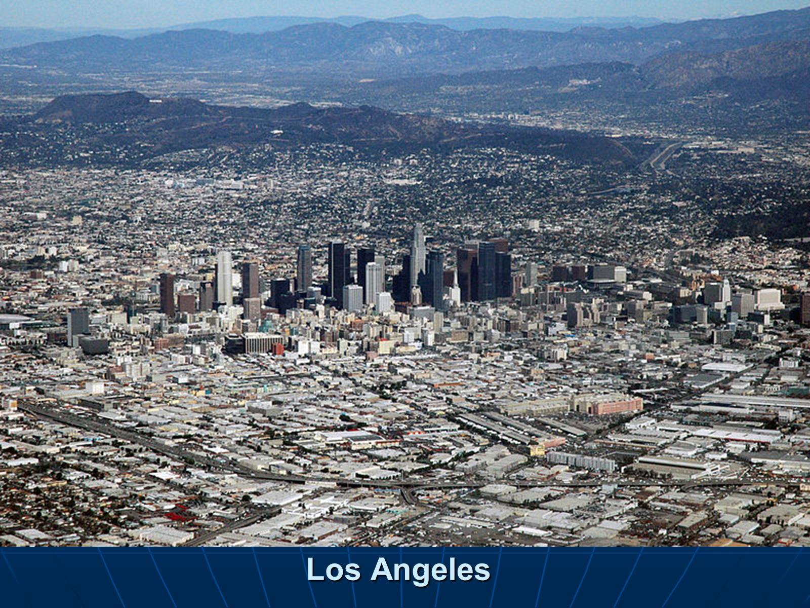
Los Angeles
Слайд #33
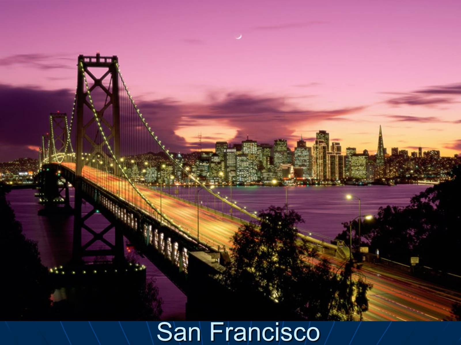
San Francisco
Слайд #34
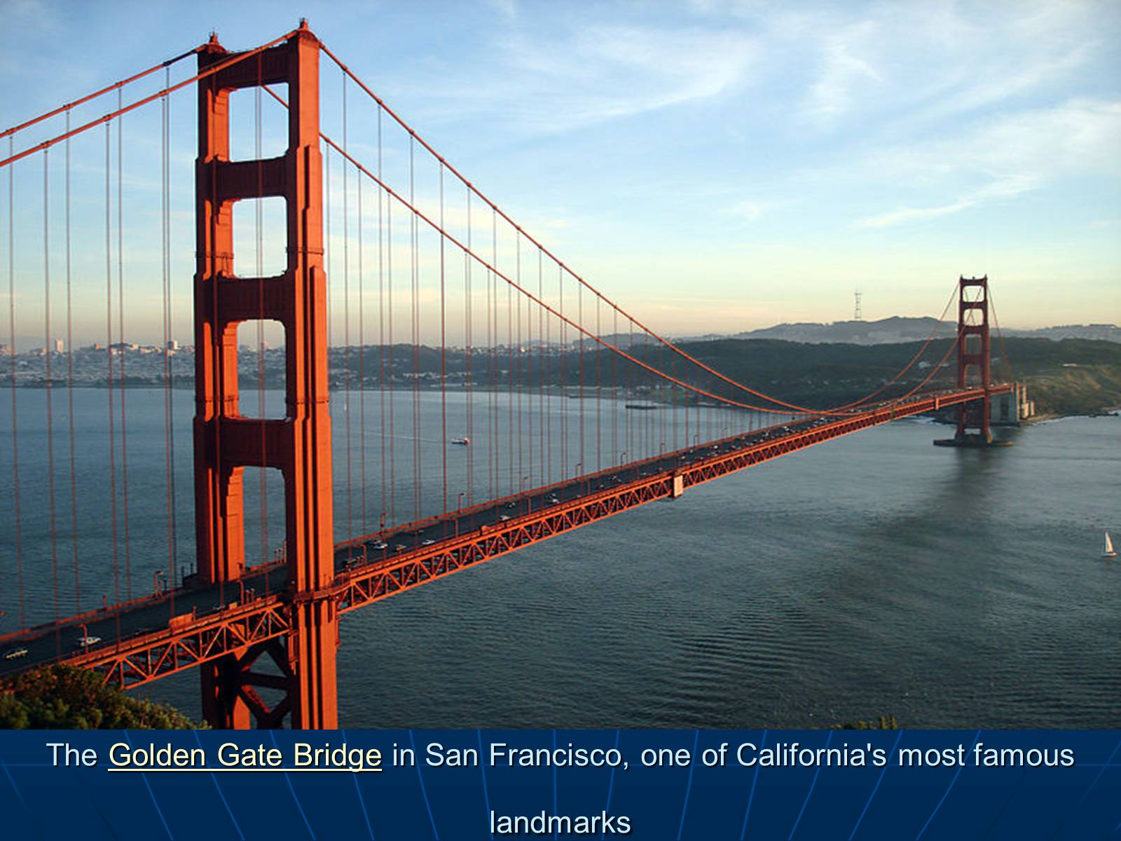
The Golden Gate Bridge in San Francisco, one of California's most famous landmarks
Слайд #35
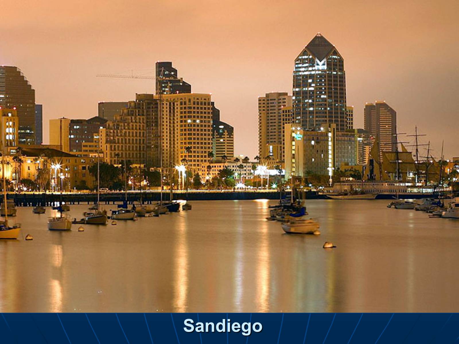
Sandiego
Слайд #36
Thank you for your attention !
